Environmental Baseline Surveys (EBS)
TDI-Brooks provides marine environmental baseline surveys (EBS) for coastal, nearshore and offshore projects for the oil & gas sector, offshore wind farm and other renewables programs, cables and pipelines. These services are provided on a global basis in GoM/Mexico, Northern South America (NSA) / Caribbean / Brazil and NW/W Africa regions.
Since inception of the EBS concept in the early 1970’s, TDI-Brooks’ scientists have been performing EBSs for clients in the most rigorous regulatory environments. Decades of experience in refining techniques, working with regulatory agencies, and developing a functional network of specialists / associates provides our clients with an effective and defensible approach to resolving environmental impact issues in the marine environment.
We provide the following:
- Shallow and Deepwater Environmental Baseline Surveys
- Environmental and Social Impact Assessment Surveys
- Mapping of Protected Habitats
- Intertidal and Terrestrial Surveys
- Metocean Surveys
- Marine Weather Forecasting
- Oil Spill Contingency Plans
- Environmental Laboratory Analysis
Environmental Baseline Studies are often required in offshore prospects as a defense against potential litigation, to satisfy leasing stipulations, and as good faith measures in responsible environmental stewardship. When performed in conjunction with TDI-Brooks’ SGE surveys, we are able to leverage our experience, logistical support, and presence to provide cost effective EBSs conducted under the stringent HSE standards that industry demands, thereby providing our client with timely solutions to environmental concerns backed with the highest scientific and technical credibility.
Our scientists have held key roles in the most high profile, prestigious Environmental Impact Assessment projects both in the US and internationally. Our client history includes USEPA, BOEM (formerly Minerals Management Service), National Oceanic and Atmospheric Administration, Office of Naval Research, and US Fish & Wildlife Service.
Download the Environmental Baseline Surveys flyer HERE
Contact us with any questions: info@tdi-bi.com
metocean surveys
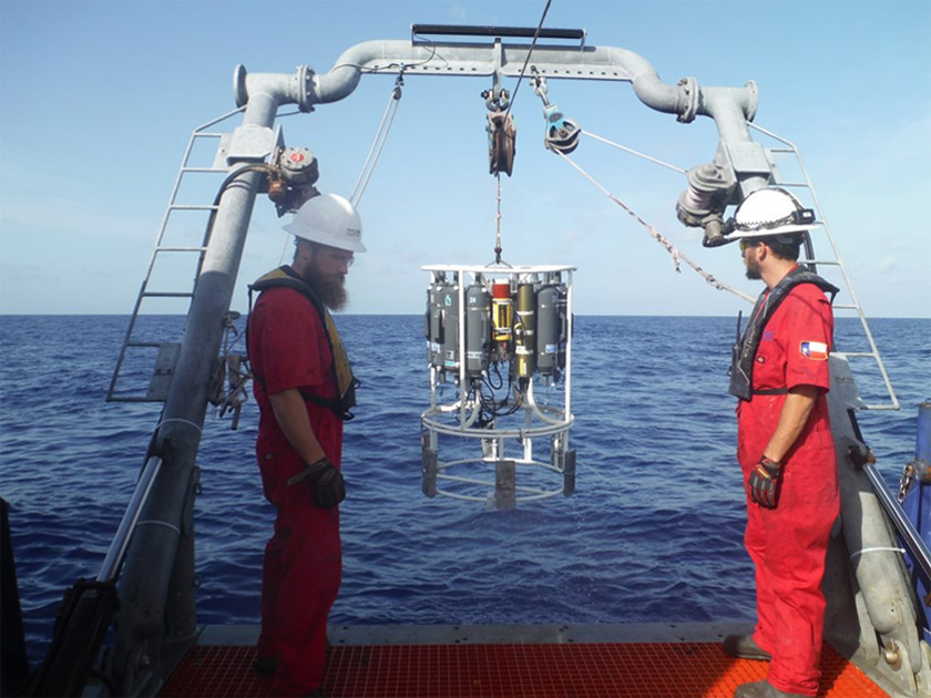
TDI-Brooks provides Metocean services to the oil and gas industry, ports and harbor authorities, renewable energy companies, government agencies, and engineering firms worldwide.
TDI-Brooks offers complete investigations for oil and gas exploration, dredging operations and offshore constructions including benthic and water sampling, long-term real-time weather, sea state and pack ice monitoring through bespoke web applications, tide and current measurements as well as underwater noise monitoring.
Before undertaking any development works within the marine environment it is important to understand the mechanics of the sometimes harsh and challenging surroundings within the proposed project area. This means developing and understanding the impacts and effects of wind, waves, currents and tidal patterns on both the existing infrastructure and any future development
We provide comprehensive feasibility and desktop studies for the initial stage of project planning where often a comprehensive pre-analysis of the existing area will lead to time and cost savings during the life cycle of the project.
TDI-Brooks uses a wide range of Metocean equipment from shallow water to deep oceans including tide gauges, wave and current meters, in-situ data loggers and meteorological stations in order to gather detailed information on the meteorological and oceanographic conditions at the survey area.
- Full water column oceanographic data acquisition, including current velocity and direction, wave spectra, tides, conductivity, and temperature (shallow waters to ultra deep waters)
- Meteorological stations, including wind, temperature, cloud height, and visibility
- Design, installation, and maintenance of tide stations for ports, exploration, and survey programs
- Integration of instrumentation and sensors through buoy-based systems or fiber networks utilizing sophisticated data processing, web display, storage, and dissemination software
- Consultancy, design and installation of acoustic monitoring systems to support offshore operations including site investigations and environmental impact assessments.
- Long-term measurements to provide information concerning acoustics and the potential effects of marine operations on the environment.
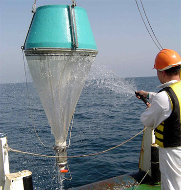
TDI-Brooks provides benthic sampling services in coastal and deep water environments using box cores and grab samplers. Benthic sampling is carried out to establish an inventory of the flora and fauna.
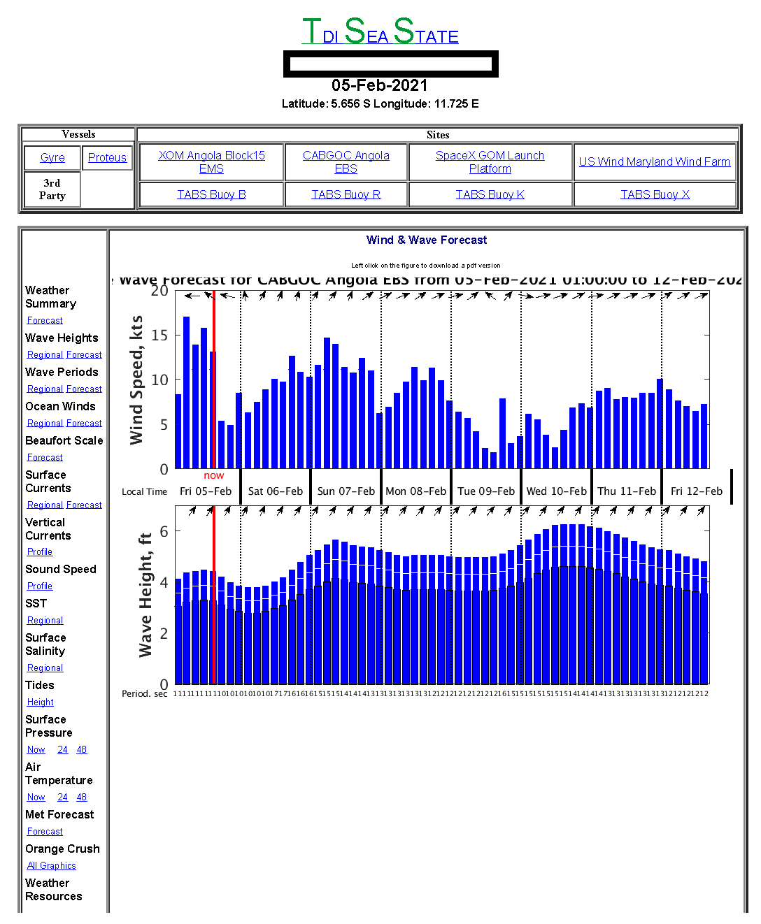
Marine Weather Forecasting
TDI-Brooks offers customized marine weather forecast services to meet the requirements of our clients operating in the offshore environment. Marine forecasting helps manage the risks and planning of offshore operations. All marine operators can safely and and accurately plan their operations in an effort to improve the safety and efficiency of the offshore operations. Our proven method has been used internally for over 250 projects with great success since 2014.
We use the most up to date technologies to provide highly accurate forecasts, ensuring operations are planned, both safely and efficiently.
We offer advanced knowledge of the wind and wave conditions which leads to safer, more efficient offshore operations.
Weather forecasts including meteorological data provides a general synopsis and any warnings (gale, hurricane, etc.).
Offshore Weather Services Offered:
- Weather forecasts for the oceans
- Day-to-day planning
- Site specific forecasts to support daily operations
- Route forecasts
- Onsite weather forecasts
- Weather downtime
- Hurricane and lighning warnings
- A summary of the wind
- Seas
- Wave and swell forecast
- Existing weather and forecast weather
- And an outlook for the appropriate period for wind, sea and swell
The Effect of Bottom Water Temperature
The temperature of the ocean water overlying the bottom, known as bottom water temperature (BWT), plays an important role in obtaining a reliable heat flow estimate. Understanding how changes to the BWT can affect a computed heat flow value is very important. If the BWT cools or heats suddenly, then this sends a temperature anomaly propagating by conduction downward into the sediments. Sometimes such changes in the BWT are responsible for large, non-linear temperature variations over the length of the 5m probe, particularly at shallow water sites. TDI-Brooks recommends that heat flow be conducted in depths greater than 600-800m because of the high risk of a BWT variation in shallow water. Normally in the deep ocean the BWT is fairly stable with depth, and varies only slightly in time. This is conducive to highly accurate and precise heat flow measurements. But BWTs may not be stable at any depth depending on the oceanographic factors.
Bottom water temperature transients have typically been identified after the fact, by recognizing a deviation from linearity in the Bullard plot and then explaining the deviation as a probable transient in the temperature of the overlying water. But it is possible to examine the bottom water temperature output of a real-time ocean model and pro-actively identify potential sites where transients could be expected to be a problem. TDI-Brooks has the capability to classify whether a potential heat flow site may be subject to a transient in the bottom water temperature. The method will correctly classify a heat flow site as stable or unstable with an accuracy exceeding 90%. For example, Figure 1 shows the computed probability of a BWT transient offshore of southern Portugal. This region is influenced by the warm and highly saline Mediterranean Outflow Water flowing out of the Gibraltar Strait and to the northwest over the Portuguese margin. The Outflow occurs between 500 and 1400m and affects the BWT of sites typically considered to be deep. Table 1 provides the specific details found by our method. The column labeled Bullard Plot shows if a transient was detected in the Bullard Plot. The column labeled Computed BWT Probability shows the computed probability of a transient. A probability greater than 30% is highly indicative of a transient. None of the site depths were less than 1100 m, yet all but two were affected by a transient. The method correctly identified eleven of the twelve sites, or 91%.
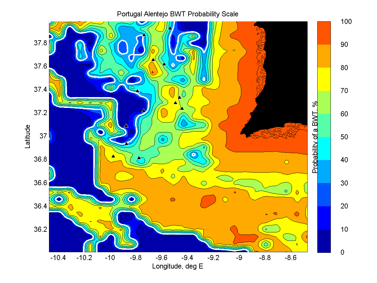
Figure 1: Probability of a BWT transient offshore of Portugal. The heat flow sites are denoted with a black triangle.
Table 7. Portugal Alentejo Heat Flow
| Station ID | Depth, m | Bullard Plot | Computed BWT Probability, % |
|---|---|---|---|
| HF-PPF-c | 1452 | BWT Transient | 78.31 |
| HF-PPF-e | 1121 | BWT Transient | 67.81 |
| HF-PPF-f | 2170 | BWT Transient | 38.33 |
| HF-PPF-g | 2751 | BWT Transient | 72.57 |
| HF-PPF-h | 2475 | BWT Transient | 55.93 |
| HF-PPF-i | 3304 | Equilibrium heat flow – no transient | 17.13 |
| HF-PPF-j | 3429 | Equilibrium heat flow – no transient | 33.60 |
| HF-PPF-k | 1247 | BWT Transient | 78.63 |
| HF-PPF-l | 1197 | BWT Transient | 63.47 |
| HF-PPF-n | 1423 | BWT Transient | 50.13 |
| HF-PPF-o | 1332 | BWT Transient | 47.07 |
| HF-PPF-p | 2140 | BWT Transient | 41.51 |
For more information, or a copy of the technical note (click here to download) further describing the method, please contact Dr. Les Bender at +1 979.693.3446 or lesbender@tdi-bi.com.
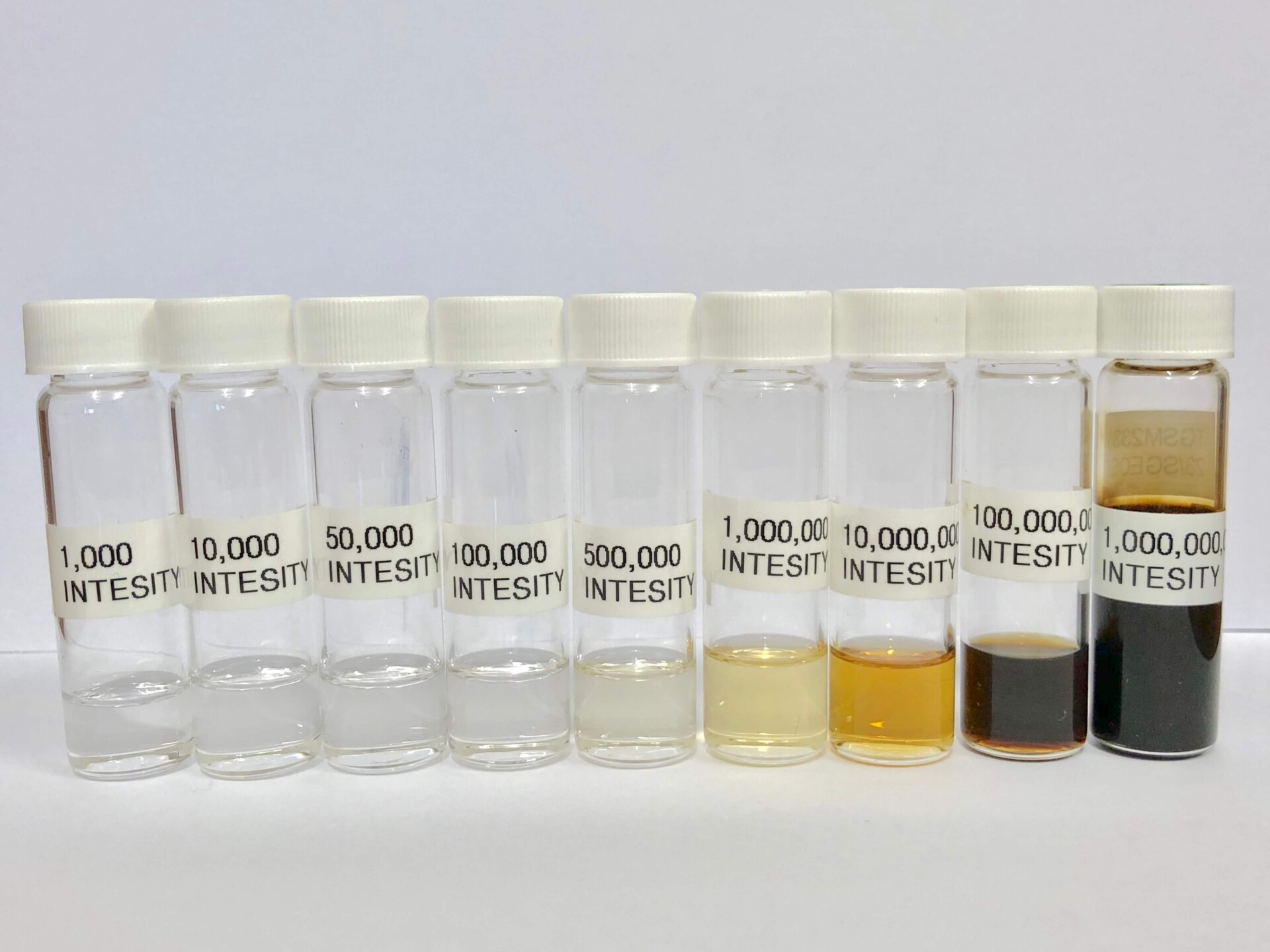
Environmental Laboratory
Our company has over 20 years of experience and has been the choice laboratory for programs such as NOAA’s Status and Trends Mussel Watch (1999-currently), United States Fish & Wildlife Analytical Control Facility (2002-currently), oil spill response as with Mississippi Canyon 252 (Deepwater Horizon) Natural Resource Damage Assessment (2010-currently).
Our company has been ISO 9001 accredited since 2011 and is currently in the process of obtaining ISO 17025:2017 accreditation.
Chemistry Laboratory Info HERE